 Click here for a zoomable map and the Strava Route
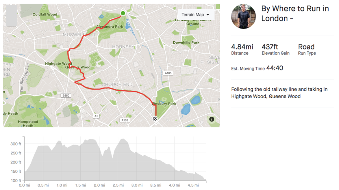
- Distance – 4.8 miles
- Surface –Tarmac paths
- Terrain – Hilly
- Surroundings – Park, woodland
- Traffic Free – No (there are some roads that link parts of the route).
The Parkland Walk follows the course of the old railway that ran between Finsbury Park and Alexandra Palace. It links the ancient woodland of Highgate Wood and Queens Wood that were originally part of the Forest of Middlesex, which covered much of London, Hertfordshire and Essex.
This route can be done as a point to point from Alexandra Park and Palace to Finsbury Park or vice versa and a loop starting and finishing at the same place and doubling the distance.
The Route
The Parkland Walk links Alexandra Palace and Park, Highgate Wood and Queens Wood and Finsbury Park and can be split into 5 sections
Start – Alexandra Palace and Park
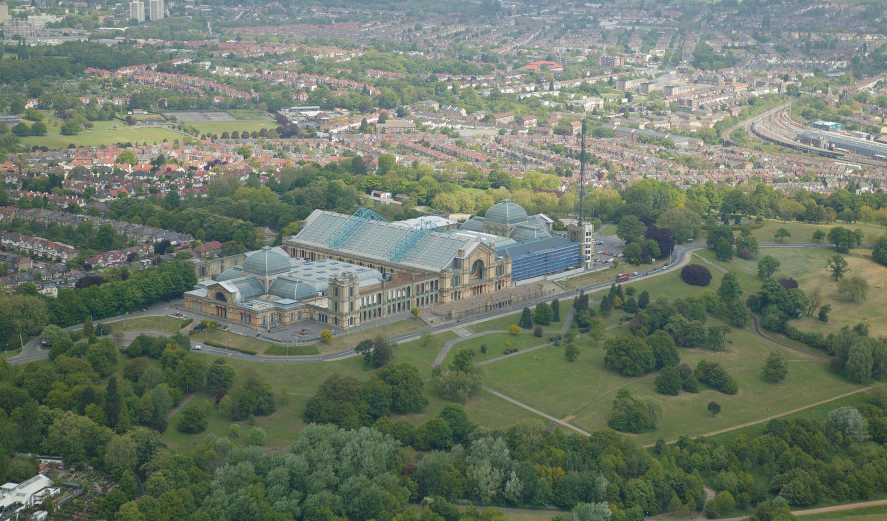
Start at Alexandra Palace train station and head towards the Palace, passing in front of it. Keep the edge of the park on your left and head towards the Grove Café and Little Dinosaurs Play Centre in the westerly most point of the park. Go out of the gate to Muswell Hill (a road).
1.0 mile – Muswell Hill to Cranley Gardens (Parkland Walk North) – 0.5miles
Cross the road and head down to the footpath (Parkland Walk North) and follow for 0.5 miles. At the end turn right and then immediately left on Muswell Hill Road. Cross the road at the pedestrian crossing and go straight into Highgate Wood.
1.5 miles – Highgate Wood and Queens Wood – 0.8 miles
Enter the wood and turn left. (Feel free to do a lap of Highgate Wood, for some extra distance). After 0.4 miles (small gate in the fence) cross Muswell Hill Road and go into Queens Wood (follow the Capital Ring route/signs). Cross through the wood to Priory Gardens (a residential street)
2.3 miles – Priory Gardens and Shepherd’s Hill (Road) – 0.4 miles
Turn left on Priory Gardens then right at Shepherd’s Hill to Archway Road. At The Boogaloo Pub on Archway Road turn onto Holmesdale Road and after 100m join the Parkland Walk again via the gate.
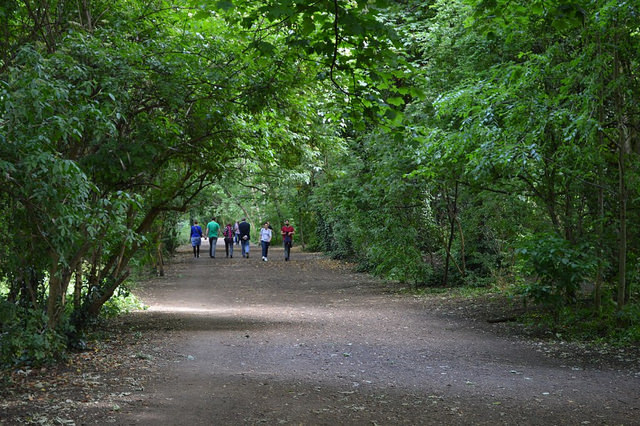
2.7 miles – Highgate to Finsbury Park (Parkland Walk) – 1.9 miles
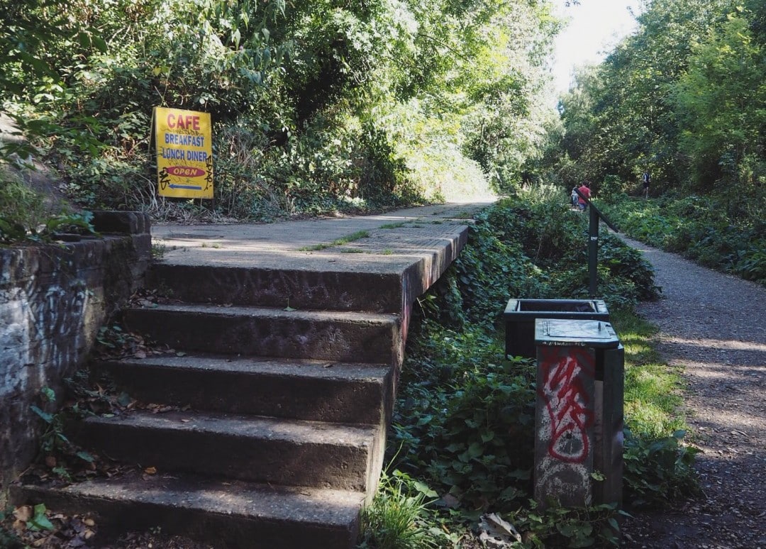
Follow the path and enjoy the natural and man-made sights along the way including the London Overground sign, remains of abandoned platforms, graffiti and sculptures.
At the end of the trail, turn right to go to Finsbury Park Station (5 miles) or do a lap of the park (an extra 1.2 miles)
Opening Times
The route has no opening and closing times. It’s not recommended to run on the route when it’s dark for safety reasons.
Getting There – Public Transport
Alexandra Palace
The nearest London Underground station is Wood Green on the Piccadilly Line. It’s 0.6 miles to the park. The nearest railway station is Alexandra Palace with services from Kings Cross station in central London. The station is next to Alexandra Park.
Finsbury Park
The nearest London Underground stations are Finsbury Park and Manor House on the Piccadilly Line and Finsbury Park on the Victoria line. Both stations both border the park. The nearest railway station is Finsbury Park with Thameslink services from Kings Cross and St Pancreas stations in central London.
Parking
There are several car parks at Alexandra Palace. See the Alexandra Palace Route here.
Strava
Click here for the Strava route which you can print or export.
Alternatively search “Where to Run in London” in the Strava app, go to “Routes”, pick the route and “Use”